Snowshoe hike to Gherardi mountain shelter
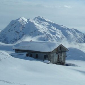
The snowshoe hike to Gherardi mountain shelter is an easy hike to the Alben plateau, in the heart of the Taleggio Valley.
The snowshoe hike to Gherardi mountain shelter is an easy hike to the Alben plateau, in the heart of the Taleggio Valley.
of Valtellina. The snowshoeing excursion to Mottaccio allows you to reach this panoramic location and enjoy magnificent views of the village of Madesimo and the Central Alps. Thanks to the moderate elevation gain and the numerous markers along the route, this snowshoeing trail is ideal for beginners and families.
Passo dei Campelli is a mountain pass that connects Val Camonica with Val di Scalve. From its altitude of around 1890 meters, you can enjoy a splendid panorama of Cimon della Bagozza and the Small Dolomites of Scalve, the Conca dei Campelli, and Val Camonica. In winter, an easy and safe snowshoeing route allows you to reach it.
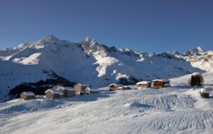
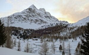
The Snowshoe hike to Nicola mountain shelter allows you to reach this refuge located in the heart of the Artavaggio plateau, an ideal location to enjoy the snow on a beautiful winter day in Lombardy. We are in Valsassina, in the province of Lecco, at the foot of the suggestive mount Sodadura, with its unmistakable pyramid shape.

Along Orobian Lecchese ridge The one described is an easy hike to Monte Ocone, on the DOL, the Orobian Lecchese ridge, which serves as a
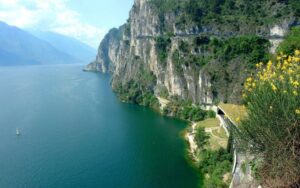
of Ledro. After being closed for 20 years, it has been rehabilitated and transformed into a cycle and pedestrian path of great charm, offering magnificent views overlooking Lake Garda.

In this article we suggest 6 ideas for activities to do in winter during your stay in Val Seriana and Val di Scalve.
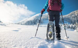
Snowshoeing is a typical winter activity to explore the mountains at a slower pace, as an alternative to skiing.
In this article we will describe 6 Snowshoeing Routes to go through in the Province of Bergamo

The peat bogs of Sebino lake are a protected area by the Lombardy region, located to the south of Iseo lake. It is characterized by reed beds and still water ponds. Its current formation is a result of human activity; until the period after World War I, this area was used for extracting peat, a material used for energy production as a substitute for coal.
Val Viola is a lateral valley of the upper Valtellina, situated along the road that ascends from Bormio to Livigno. We are within a remarkable natural setting, both due to the altitude of the route and the majesty of the surrounding peaks. Snowshoeing in Val Viola, however, is safe and easily doable, as despite the considerable distance (almost 11 km), the elevation gain is moderate and allows reaching the Caricc refuge/farm, which is open in winter. The route consists of two variants, a “High” one and a “Low” one. In this article, we describe the loop by taking the low variant on the way there and the high variant on the return. The low route is generally very safe and less prone to avalanche risk. Before embarking on the high route, it’s advisable to check the weather and snow reports.